Another Quadtree Map Rendering
This will be a quick post: I've got another population-based map rendering to
share, based on the work described in this post.
The Rendering #
This rendering uses tiles at Google Maps zoom level 14:
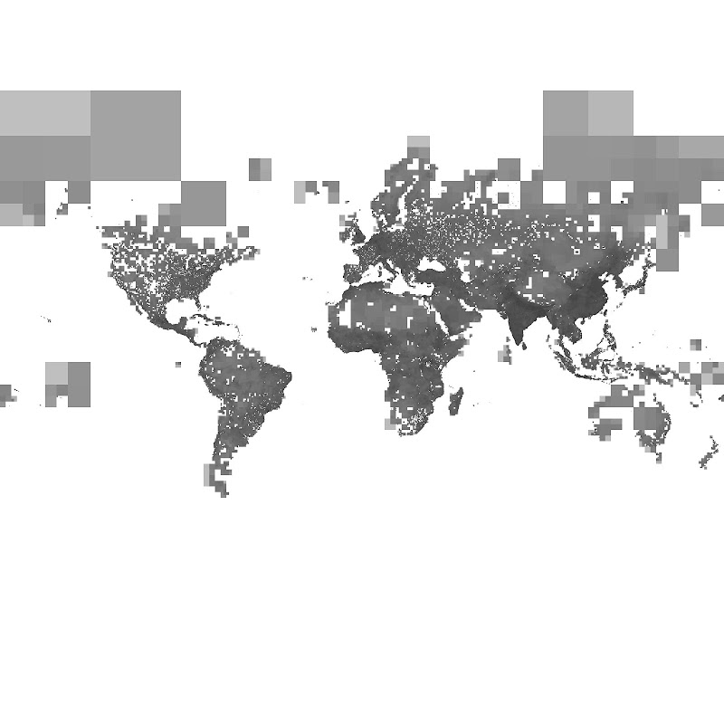
I decided to experiment with solid shading rather than wireframe for the tiles. This cuts down on the Moiré effect in densely populated areas.
The original is a whopping 1 gigapixels, so I had to resize it using ImageMagick before uploading it to Picasa:
$ convert tiles14.jpg -sample 2048x2048 tiles14.2048.jpgA few more random tidbits of information:
- Computing the tile subdivision took one CPU-hour on my laptop, a fairly new MacBook Air.
- At zoom level 14, tiles near the equator are roughly 1.5 miles to a side. (Tiles further north or south are shorter in the north-south direction due to distortion in the Mercator projection.)
- The Nile is clearly visible between the Nile Delta and Aswan.
Next Post #
In my next post, I'll dive into six months of journal entries from a six-month bike trip that Valkyrie Savage and I took back in 2010.
- Next: A Tale of Two Trips
- Previous: Quadtree Cartography